Category:Redgrave, Suffolk
Jump to navigation
Jump to search
village in Suffolk, England  | |||||
| Upload media | |||||
| Instance of | |||||
|---|---|---|---|---|---|
| Location | Mid Suffolk, Suffolk, East of England, England | ||||
 | |||||
English: Redgrave is a civil parish and a small village in the Rickinghall and Walsham ward in the Mid Suffolk district in Suffolk county in eastern England.
Subcategories
This category has the following 6 subcategories, out of 6 total.
C
- The Cross Keys, Redgrave (7 F)
H
- Redgrave Hall (9 F)
M
P
- Post boxes in Redgrave, Suffolk (16 F)
V
- Redgrave Village Sign (7 F)
Media in category "Redgrave, Suffolk"
The following 156 files are in this category, out of 156 total.
-

-
 All Saints Church, Redgrave - geograph.org.uk - 4373330.jpg 3,072 × 2,304; 2.58 MB
-
 All Saints Church, Redgrave - geograph.org.uk - 4373332.jpg 3,072 × 2,304; 1.92 MB
-
 B1113 Hall Lane, Redgrave - geograph.org.uk - 4373340.jpg 3,072 × 2,092; 2.9 MB
-
 B1113 Hall Lane, Redgrave - geograph.org.uk - 4373350.jpg 3,072 × 2,304; 2.18 MB
-
 B1113 Hall Lane, Redgrave - geograph.org.uk - 4378502.jpg 2,995 × 2,244; 2.41 MB
-
 B1113 Hall Lane, Redgrave - geograph.org.uk - 4379099.jpg 3,072 × 2,304; 1.32 MB
-
 B1113 Hall Lane, Redgrave - geograph.org.uk - 4379177.jpg 3,072 × 2,304; 2.36 MB
-
 B1113 Redgrave Road, Redgrave - geograph.org.uk - 5051393.jpg 3,072 × 2,304; 1.7 MB
-
 B1113 The Street, Redgrave - geograph.org.uk - 4372425.jpg 3,072 × 2,304; 1.83 MB
-
 B1113 The Street, Redgrave - geograph.org.uk - 4372426.jpg 3,072 × 2,304; 1.75 MB
-
 B1113 The Street, Redgrave - geograph.org.uk - 4372433.jpg 3,072 × 2,304; 1.94 MB
-
 B1113 The Street, Redgrave - geograph.org.uk - 4373356.jpg 3,072 × 2,304; 1.91 MB
-
 B1113 The Street, Redgrave - geograph.org.uk - 4373453.jpg 3,072 × 2,304; 2.16 MB
-
 B1113 The Street, Redgrave - geograph.org.uk - 4373468.jpg 3,072 × 2,304; 1.69 MB
-
 B1113 The Street, Redgrave - geograph.org.uk - 4373476.jpg 3,072 × 2,304; 1.85 MB
-
 B1113 The Street, Redgrave - geograph.org.uk - 4373529.jpg 3,072 × 2,304; 3 MB
-
 B1113 The Street, Redgrave - geograph.org.uk - 4375284.jpg 3,072 × 2,304; 1.87 MB
-
 B1113 The Street, Redgrave - geograph.org.uk - 4375334.jpg 2,304 × 3,072; 2.91 MB
-
 B1113 The Street, Redgrave - geograph.org.uk - 4377749.jpg 3,072 × 2,304; 2.85 MB
-
 B1113 The Street, Redgrave - geograph.org.uk - 4377760.jpg 3,072 × 2,304; 2.41 MB
-
 Bier Lane footpath to Fen Street - geograph.org.uk - 4371296.jpg 3,072 × 2,304; 1.97 MB
-
 Botesdale Village Name sign - geograph.org.uk - 4379208.jpg 2,946 × 2,207; 3.37 MB
-
 Bridge on the B1113 Hall Lane - geograph.org.uk - 4379192.jpg 2,935 × 1,811; 1.62 MB
-
 Churchway sign - geograph.org.uk - 4372423.jpg 3,072 × 2,304; 1.93 MB
-
 Churchway ^ footpath - geograph.org.uk - 4371295.jpg 3,072 × 2,304; 1.8 MB
-
 Churchway ^ footpath - geograph.org.uk - 4372256.jpg 3,072 × 2,202; 2.49 MB
-
 Churchway ^ footpath - geograph.org.uk - 4372264.jpg 3,072 × 2,304; 1.81 MB
-
 Churchway, Redgrave - geograph.org.uk - 4371279.jpg 3,072 × 2,304; 1.92 MB
-
 Churchway, Redgrave - geograph.org.uk - 4372245.jpg 3,072 × 2,304; 1.76 MB
-
 Churchway, Redgrave - geograph.org.uk - 4372271.jpg 3,072 × 2,304; 1.85 MB
-
 Churchway, Redgrave - geograph.org.uk - 4372275.jpg 3,072 × 2,304; 1.82 MB
-
 Churchway, Redgrave - geograph.org.uk - 4372311.jpg 3,072 × 2,304; 1.69 MB
-
 Churchway, Redgrave - geograph.org.uk - 4372428.jpg 3,072 × 2,304; 1.72 MB
-
 Churchway, Redgrave - geograph.org.uk - 4373373.jpg 3,072 × 2,304; 2.63 MB
-
 Churchway, Redgrave - geograph.org.uk - 4373375.jpg 3,072 × 2,304; 3.42 MB
-
 Churchway, Redgrave - geograph.org.uk - 4373410.jpg 3,072 × 2,304; 2.01 MB
-
 Churchway, Redgrave - geograph.org.uk - 913476.jpg 640 × 480; 74 KB
-
 Crackthorn Bridge on Hinderclay Road - geograph.org.uk - 4375376.jpg 3,072 × 2,304; 1.95 MB
-
 Crackthorn Bridge on Hinderclay Road - geograph.org.uk - 4377790.jpg 3,072 × 2,304; 1.9 MB
-
 Cultivated fields east of Redgrave - geograph.org.uk - 2049457.jpg 640 × 480; 212 KB
-

-

-
 Dudleys Close sign - geograph.org.uk - 4373459.jpg 2,970 × 2,225; 3.23 MB
-
 Dudleys Close, Redgrave - geograph.org.uk - 4373455.jpg 3,072 × 2,304; 1.69 MB
-
 Entering Botesdale on the B1113 Hall Lane - geograph.org.uk - 4379205.jpg 2,946 × 2,207; 2.49 MB
-
 Entering Norfolk on the B1113 Redgrave Road - geograph.org.uk - 5051405.jpg 3,072 × 2,304; 1.72 MB
-
 Entering Redgrave on the B1113 Hall Lane - geograph.org.uk - 4379049.jpg 3,072 × 2,304; 2.31 MB
-
 Entering Redgrave on the B1113 Redgrave Road - geograph.org.uk - 5051395.jpg 3,072 × 2,304; 1.93 MB
-
 Entering Redgrave on the B1113 Redgrave Road - geograph.org.uk - 5051414.jpg 2,806 × 2,105; 4.77 MB
-
 Entering Suffolk on the B1113 Redgrave Road - geograph.org.uk - 5051388.jpg 2,968 × 2,164; 4.69 MB
-
 Entrance of Redgrave Cricket Ground - geograph.org.uk - 4373405.jpg 3,072 × 2,304; 2.74 MB
-
 Entrance to Hall Farm - geograph.org.uk - 4372202.jpg 3,072 × 2,304; 1.76 MB
-
 Entrance to Hall Farm - geograph.org.uk - 4372234.jpg 3,072 × 2,304; 1.91 MB
-
 Entrance to Redgrave Business Centre - geograph.org.uk - 4373479.jpg 3,072 × 2,304; 2.02 MB
-
 Farmers Bridge - geograph.org.uk - 1260511.jpg 640 × 480; 97 KB
-
 Fen Street, Redgrave - geograph.org.uk - 4375288.jpg 3,072 × 2,304; 1.72 MB
-

-
 Five Sleeper Bridge - geograph.org.uk - 1710663.jpg 1,200 × 1,600; 570 KB
-
-
 Footbridge over a ditch - geograph.org.uk - 2049427.jpg 480 × 640; 289 KB
-
 Footpath off Churchway - geograph.org.uk - 4372260.jpg 3,072 × 2,304; 1.92 MB
-
 Footpath off Churchway - geograph.org.uk - 4372267.jpg 3,072 × 2,304; 1.88 MB
-
 Footpath off Churchway - geograph.org.uk - 4372279.jpg 3,072 × 2,202; 2.27 MB
-
-
 Gressingham sign - geograph.org.uk - 4375366.jpg 2,253 × 2,993; 4.46 MB
-
 Half Moon Lane, Redgrave - geograph.org.uk - 4378499.jpg 3,072 × 2,304; 1.88 MB
-
 Half Moon Lane, Redgrave - geograph.org.uk - 4379143.jpg 3,072 × 2,304; 2.95 MB
-
 Half Moon Lane, Redgrave - geograph.org.uk - 4379169.jpg 3,072 × 2,304; 2.76 MB
-
 Half Moon Lane, Redgrave, Suffolk - geograph.org.uk - 226327.jpg 640 × 425; 95 KB
-
 Hall Farm sign - geograph.org.uk - 4372207.jpg 2,127 × 2,828; 4.91 MB
-
 Hall Farm, Redgrave - geograph.org.uk - 4372249.jpg 3,072 × 1,581; 1.02 MB
-
 Hinderclay Road sign - geograph.org.uk - 4375299.jpg 2,970 × 2,225; 3.66 MB
-
 Hinderclay Road, Redgrave - geograph.org.uk - 4373536.jpg 3,072 × 2,304; 1.73 MB
-
 Hinderclay Road, Redgrave - geograph.org.uk - 4375279.jpg 3,072 × 2,304; 1.81 MB
-
 Hinderclay Road, Redgrave - geograph.org.uk - 4375358.jpg 3,072 × 2,304; 1.88 MB
-
 Hinderclay Road, Redgrave - geograph.org.uk - 4377841.jpg 3,072 × 2,304; 2.35 MB
-

-
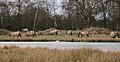
 Konik Ponies, Redgrave and Lopham Fen - geograph.org.uk - 2111488.jpg 1,600 × 1,197; 1,022 KB
-
 Little Ouse River at Crackthorn Bridge - geograph.org.uk - 4375382.jpg 3,072 × 2,304; 4.65 MB
-
 Little Ouse River at Crackthorn Bridge - geograph.org.uk - 4375386.jpg 2,304 × 3,072; 5.79 MB
-

-
 Moneypot Hill - geograph.org.uk - 2136565.jpg 3,648 × 2,736; 1.51 MB
-
 Norfolk County Name sign on the B1113 Redgrave Road - geograph.org.uk - 5051408.jpg 2,990 × 2,242; 6.34 MB
-
 Norfolk Suffolk border - geograph.org.uk - 2100983.jpg 1,600 × 1,200; 1.03 MB
-
 Path on Redgrave and Lopham Fen - geograph.org.uk - 2100991.jpg 1,600 × 1,200; 1.34 MB
-
 Pig field by B1113 - geograph.org.uk - 2100989.jpg 1,600 × 1,200; 787 KB
-
 Pigs off Hinderclay Road - geograph.org.uk - 4375348.jpg 3,072 × 2,304; 2.13 MB
-
 Plaque at Redgrave Cricket Ground - geograph.org.uk - 4373392.jpg 2,304 × 3,072; 6.34 MB
-
 Pond on Churchway - geograph.org.uk - 4372427.jpg 3,072 × 2,304; 1.84 MB
-
 Poppies growing on Pye's Lane - geograph.org.uk - 2049452.jpg 480 × 640; 305 KB
-
 Private Road - geograph.org.uk - 1708189.jpg 1,600 × 1,200; 610 KB
-
 Public footpath to Churchway, Redgrave - geograph.org.uk - 2049441.jpg 640 × 480; 243 KB
-
 Public footpath to Redgrave - geograph.org.uk - 2049415.jpg 640 × 480; 300 KB
-
 Pye's Lane - geograph.org.uk - 2049461.jpg 640 × 480; 228 KB
-
 Rectory Green, Redgrave - geograph.org.uk - 4373346.jpg 3,072 × 2,304; 1.94 MB
-
 Redgrave Activities Centre - geograph.org.uk - 4373378.jpg 3,072 × 2,304; 2.83 MB
-
 Redgrave Activities Centre - geograph.org.uk - 4373380.jpg 3,072 × 2,304; 2.22 MB
-
 Redgrave Activities Centre sign - geograph.org.uk - 4373382.jpg 2,304 × 3,072; 2.16 MB
-
 Redgrave Activities Centre ^ Cricket Ground - geograph.org.uk - 4373446.jpg 3,072 × 2,304; 2.54 MB
-
 Redgrave Business Centre sign - geograph.org.uk - 4373480.jpg 3,072 × 2,304; 2.02 MB
-

-
 Redgrave Cricket Ground - geograph.org.uk - 4373365.jpg 3,072 × 2,304; 2.15 MB
-
 Redgrave Cricket Ground - geograph.org.uk - 4373368.jpg 3,072 × 2,304; 2.26 MB
-
 Redgrave Cricket Ground - geograph.org.uk - 4373387.jpg 3,072 × 2,304; 1.35 MB
-
 Redgrave Fen - geograph.org.uk - 2110355.jpg 1,600 × 1,200; 1.06 MB
-
 Redgrave Road, Redgrave - geograph.org.uk - 4371276.jpg 3,072 × 2,304; 1.81 MB
-
 Redgrave Shop - geograph.org.uk - 4372434.jpg 3,072 × 1,876; 1.25 MB
-
 Redgrave Shop - geograph.org.uk - 4373319.jpg 2,304 × 3,072; 2.03 MB
-
 Redgrave Village Name sign - geograph.org.uk - 4379058.jpg 3,046 × 2,282; 3.54 MB
-
 Redgrave Village Name sign - geograph.org.uk - 4379084.jpg 2,239 × 2,968; 2.9 MB
-
 Redgrave Village Name sign on the B1113 Redgrave Road - geograph.org.uk - 5051396.jpg 2,283 × 3,044; 4.76 MB
-
 Redgrave Village Name sign on the B1113 Redgrave Road - geograph.org.uk - 5051416.jpg 3,072 × 2,304; 1.85 MB
-
 Redgrave Village Name sign on the B1113 Redgrave Road - geograph.org.uk - 5052152.jpg 3,072 × 2,304; 1.98 MB
-
 River Waveney - geograph.org.uk - 2111449.jpg 1,600 × 1,200; 767 KB
-
 River Waveney - geograph.org.uk - 2111500.jpg 1,600 × 1,200; 911 KB
-

-
 Roadsign on Churchway - geograph.org.uk - 4372424.jpg 2,304 × 3,072; 2.62 MB
-
 Roadsign on Fen Street - geograph.org.uk - 4375295.jpg 2,253 × 2,995; 6.44 MB
-
 Roadsign on Fen Street - geograph.org.uk - 4375307.jpg 2,304 × 3,072; 4.43 MB
-
 Roadsign on the B1113 Hall Lane - geograph.org.uk - 4378507.jpg 2,127 × 2,836; 2.27 MB
-
 Roadsign on Wash Lane - geograph.org.uk - 4371239.jpg 2,304 × 3,072; 2.43 MB
-
 Roadsign on Wash Lane - geograph.org.uk - 4371241.jpg 2,304 × 3,072; 2.43 MB
-
 Scarce Emerald Damselfly (Lestes dryas) - geograph.org.uk - 2100946.jpg 1,395 × 1,600; 298 KB
-
 Sheds at Hall Farm, Redgrave - geograph.org.uk - 2049438.jpg 640 × 480; 255 KB
-
 Source of the River Waveney - geograph.org.uk - 2101005.jpg 1,600 × 1,200; 1.03 MB
-
 Steps to Redgrave Cricket Ground - geograph.org.uk - 4373397.jpg 2,159 × 2,871; 2.63 MB
-
 Suffolk County Name sign on the B1113 Redgrave Road - geograph.org.uk - 5051375.jpg 3,072 × 2,304; 1.87 MB
-
 Sugar beet as far as the eye can see - geograph.org.uk - 2049458.jpg 480 × 640; 245 KB
-

-
 The Sink, Redgrave Fen - geograph.org.uk - 2110351.jpg 1,600 × 1,200; 876 KB
-
 The Street sign - geograph.org.uk - 4375277.jpg 3,072 × 2,304; 1.94 MB
-
 The Street sign - geograph.org.uk - 4378509.jpg 3,072 × 2,304; 1.87 MB
-
 The Street, Redgrave, Suffolk - geograph.org.uk - 226326.jpg 640 × 425; 87 KB
-
 Thelnetham Fen - geograph.org.uk - 433336.jpg 427 × 640; 176 KB
-
 Wash Lane, Redgrave - geograph.org.uk - 4371176.jpg 3,072 × 2,207; 1.28 MB
-
 Wash Lane, Redgrave - geograph.org.uk - 4371180.jpg 3,072 × 2,304; 3.19 MB
-
 Wash Lane, Redgrave - geograph.org.uk - 4371281.jpg 3,072 × 2,304; 1.78 MB
-
 Water Main Marker - geograph.org.uk - 1710697.jpg 1,200 × 1,600; 749 KB
-
 Water Treatment Works - geograph.org.uk - 1291480.jpg 640 × 480; 119 KB
-
 Water treatment works by Redgrave Fen - geograph.org.uk - 2110374.jpg 1,600 × 1,200; 933 KB
-
 Waveney trail, Redgrave and Lopham Fen - geograph.org.uk - 2110387.jpg 1,600 × 1,200; 1.26 MB
-
 Wild Konik ponies.jpg 1,729 × 887; 753 KB
-
 Woodland south of Hall Farm, Redgrave - geograph.org.uk - 2049433.jpg 640 × 480; 208 KB
-
 Woodland Trail, Redgrave and Lopham Fen - geograph.org.uk - 2111458.jpg 1,200 × 1,600; 1.24 MB
-
 Work in progress^ - geograph.org.uk - 565108.jpg 640 × 480; 88 KB
-
 Abandoned house near Bridge Farm - geograph.org.uk - 223124.jpg 640 × 480; 82 KB
-
 Bridge and footpath to Fen Road - geograph.org.uk - 354175.jpg 640 × 427; 137 KB
-
 Byway to Hinderclay - geograph.org.uk - 338102.jpg 640 × 427; 66 KB
-
 Byway to Holiday Farm - geograph.org.uk - 338103.jpg 640 × 423; 58 KB
-
 East Anglian watershed - geograph.org.uk - 741747.jpg 640 × 480; 120 KB
-
 Fen Road at Holiday Farm - geograph.org.uk - 223126.jpg 640 × 480; 113 KB
-
 Field near Pond Farm, Fen Street - geograph.org.uk - 223118.jpg 640 × 480; 97 KB
-
 Little Fen - geograph.org.uk - 338100.jpg 640 × 424; 100 KB
-
 Redgrave Common - geograph.org.uk - 223121.jpg 640 × 480; 129 KB
-
 Tin barns - geograph.org.uk - 317296.jpg 640 × 480; 130 KB


_-_geograph.org.uk_-_2100946.jpg)


